 Menu
Menu
- Projects
- Lafayette Parish Tax Assessor Mapping Software
Projects
Lafayette Parish Tax Assessor Mapping Software

Client
Lafayette Consolidated Government
Division
Information Technology/GIS
Scope
GIS, Software Development
Completion
2012
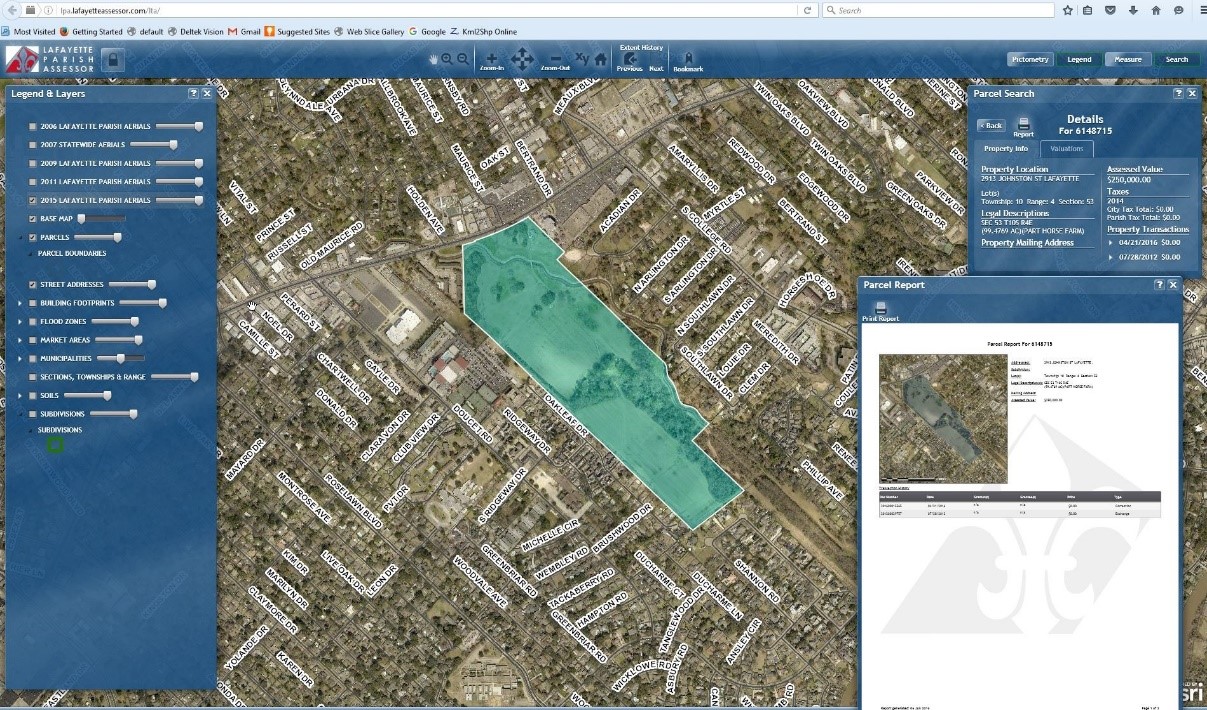
 The goal of the project was to develop a mapping application software system that would allow the Lafayette Parish Tax Assessor to manage tax assessment data more efficiently. This was accomplished with a database system and mapping application that allowed for greater visual analysis, thorough error correction, and preparation for submission to the State Tax Commission.
The GIS web application gave the Lafayette Parish Tax Assessor the capability to access a wide range of detailed information about individual properties, neighborhoods and the communities. The software system allows the public to interact, solicit, update and scrutinize property data. An interface to PictometryTM, provides users with up-close images using oblique photography for fast, accurate measurement of physical property components. Robust search capabilities allow users to explore the geographic data by attributes, parcels and features.
Related Capabilities
- Markets
- Services
- Technologies
Your company’s success is our business
Discover our industry-leading products and service that our customers have been trusting in for decades. Whatever your need, we’re here.