 Menu
Menu
- Projects
- Oil & Gas Field As-Builts
Projects
Oil & Gas Field As-Builts

Division
Exploration & Production, Pipeline
Scope
As-built survey, mapping
Completion
2019
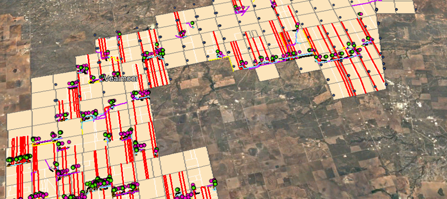
In 2018 a major oil and gas company kicked off an initiative to catalog their entire inventory in Bordon and Howard counties. The company had recently acquired fields near their own and had learned that a lot of the area had never been officially documented. Near the end of that year, the company tasked Fenstermaker’s survey team to conduct the field work needed to locate the infrastructure on the ground and to create an interactive GIS database that could be used by the company and by 911/Wild Well response teams in the future.
In February 2019, Fenstermaker began the field work which included locating all facilities, valves, flowlines, well pads, and other permanent infrastructure within the project area. Since Fenstermaker did not create the records associated with what existed on the ground, the team conducted an internal detailed review of the data to avoid missing any features in the field. Field crews utilized GPS/RTK survey technology and collected location data of each feature. The data were attributed with detailed information that could be recalled in the company’s GIS system upon command. The field work covered over 100,000 acres and took approximately 8 months to complete. Multiple survey technicians internally reviewed all data collected. After review, the team’s GIS specialist compiled the data, developed the final database, and submitted the database to the client.
Related Capabilities
- Markets
- Services
- Technologies
Your company’s success is our business
Discover our industry-leading products and service that our customers have been trusting in for decades. Whatever your need, we’re here.