 Menu
Menu
- Projects
- LSU University Lakes Bathymetric Survey Project

Projects
LSU University Lakes Bathymetric Survey Project
Client
University Lakes, LLC
Division
Advanced Technology - Coastal
Scope
Topographic, Bathymetric, Magnetometer, Stump Identification Surveys
Completion
2021
In 2016 the Baton Rouge Area Foundation began developing a master vision for the University Lakes System. This process would include detailed bathymetric survey of each lake’s bottom and field survey surrounding area, a detailed design of the entire lakes systems and the development of construction documents to be used to build out the vision of the lakes and its surroundings amenities.

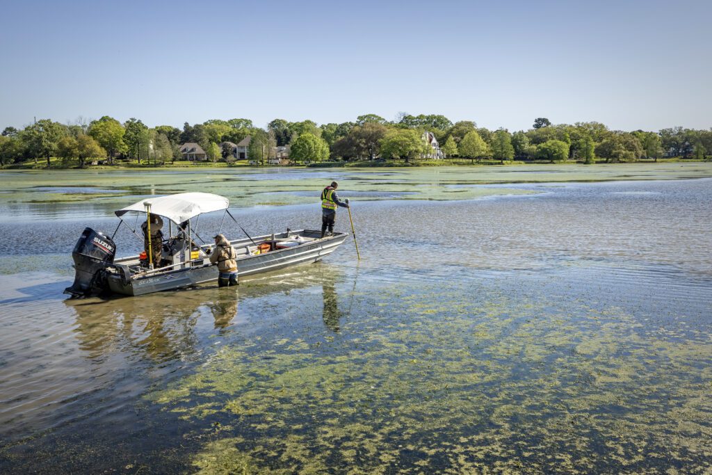
Fenstermaker survey technicians, from left, Richard Tauzin, Kyle Lanclos and Erick Kidder pull their boat through shallow water in City Park Lake while mapping the lake’s depth Thursday, April 1, 2021.
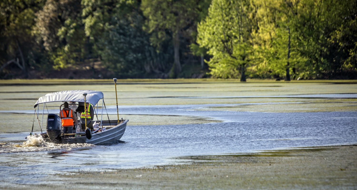
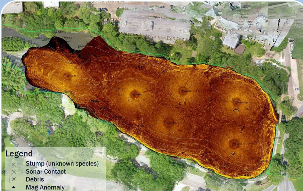
Fenstermaker conducted bathymetric and stump identification surveys for the project. Due to the shallow water depth of the lakes, Fenstermaker developed a creative approach to the project which consisted of using a dual frequency echo sounder to collect both the water bottom and the unconsolidated fluff layer in the deeper parts of the lake, while field personnel navigated the shallower parts in an air boats utilizing traditional pole sounds methods to obtain data. Once the water bottom data was collected, high-resolution imagery was obtained with drones and computer AI to locate stumps that were shallow enough to be seen in the imagery. For the deeper stumps, side scan sonar system was deployed within each lake at various locations to collect accurate imagery of the water bottom. Each image was carefully analyzed and geo-rectified into position making an overall image of the lake bottoms from which underwater stumps and anomalies could be identified and reported to the design team.
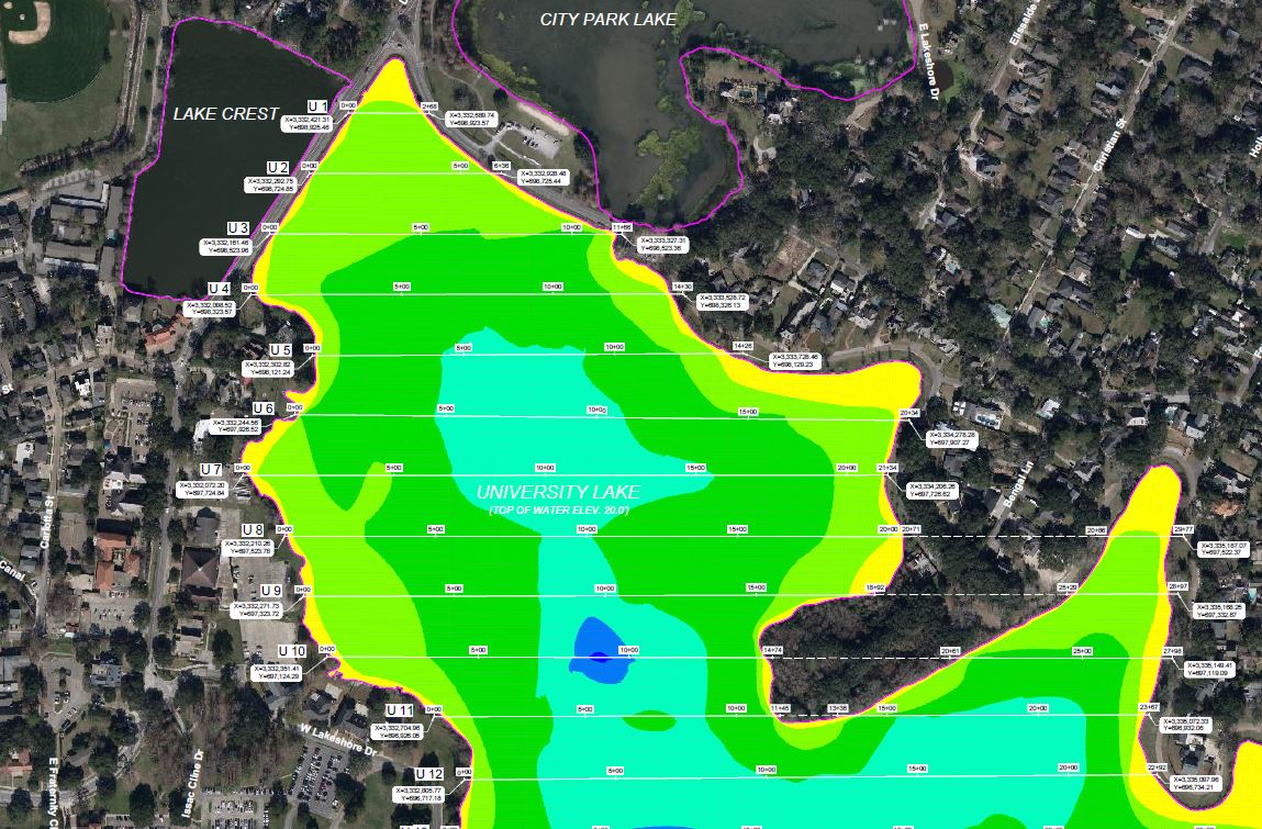
Deliverables included detailed survey reports, contour maps, digital elevation models (DEM), and stump identification maps. For more information on this project, or if you would like to request our services, please contact Fenstermaker for all your survey needs.

Stump Identification Map showing Sonar Drops

Bathymetric Survey deliverable displaying water bottom depths in University Lake
Related Capabilities
- Markets
- Services
Your company’s success is our business
Discover our industry-leading products and service that our customers have been trusting in for decades. Whatever your need, we’re here.